
UAT Risk Dashboard — Operational multi-hazard platform for UAT
Executive summary
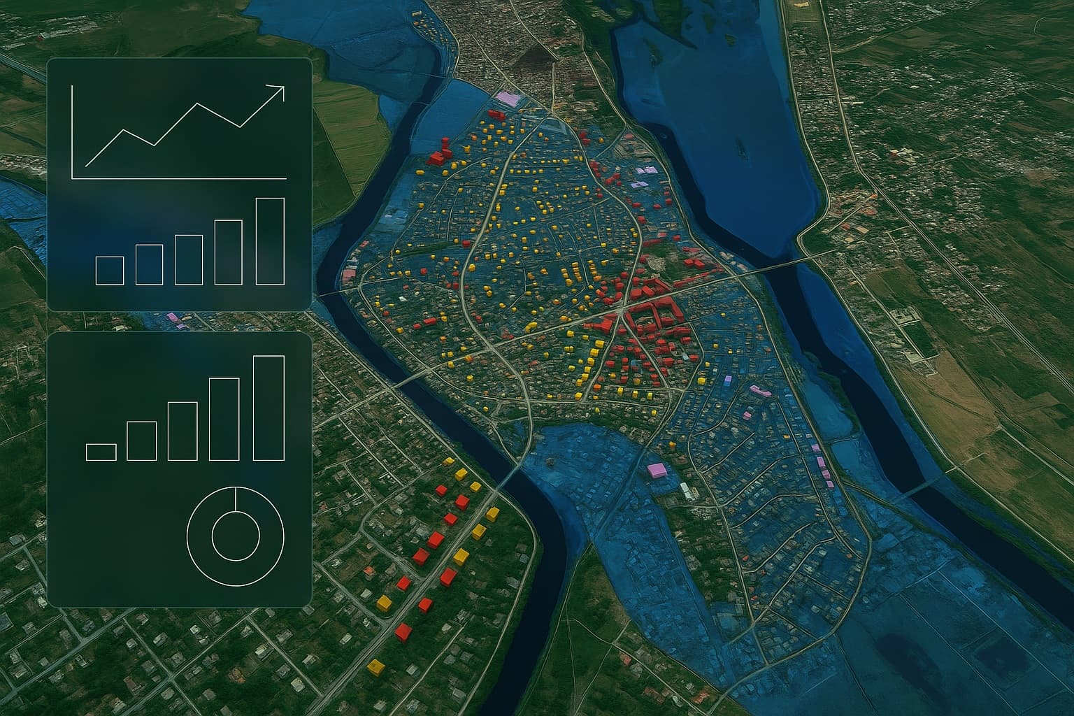
UAT Risk Dashboard brings together hydrologic, geomorphologic, and climate data in a unified geospatial interface for urban planning, civil protection, and infrastructure management. You get Global Risk, per-hazard scores (0–100), a decision traffic light and standardized reports.
Key capabilities
Multi-hazard maps
Floods 1% & 1%CC, Landslides, Erosion (sheet/rill/gully); optional torrents & urban pluvial.
AOI analysis
Address/ID search, draw/upload polygon, intersection (%/ha) or minimum distance to hazard.
Affected assets
Buildings (residential/critical), km of roads, sensitive sites, networks—filters, sorting, export.
Indicators & scores
0–100 per-hazard scores + Global Risk, confidence level (data quality & model stability).
Operational workflows
Worklists (tasking), intervention prioritization, notes/attachments, audit trail.
Reports & exports
Classic/Pro PDFs, CSV/GeoJSON, sheets with unique IDs; webhook to CRM/DMS.
Recommended modules
Urban planning & permitting
Pre-screening applications; standard indicators in certificates/approvals.
Civil protection
5/10/15-min buffers & evacuation, access routes, flow corridors.
Infrastructure & heritage
Critical buildings, roads, utilities—scores, proximities, prioritization.
Agriculture & peri-urban
Prioritize anti-erosion measures; buffers, swales, micro-retentions.
Portfolio monitoring
Upload batches (addresses/assets) and schedule periodic re-evaluation.
Scenarios & simulations
What-if, before/after, intervention plans.
Data, methodology, governance
Quantellis Inventory: proprietary hydrologic & geomorphologic datasets, versioned and updated monthly (changelog & release notes). Every analysis retains the data version, timestamp, sources & parameters → full reproducibility.
- AOI–hazard intersection → map + affected %/ha.
- No intersection → minimum distance to the hazard band/boundary.
- Result quality → confidence level (data consistency, model stability).
Operations & integration
EU hosting
On-prem/hybrid options, backup & retention.
Interoperability
WMS/WMTS, GeoPackage/GeoJSON/CSV, webhooks; integration with local registries.
Performance & security
Caching, incremental loading, high availability; GDPR, roles, logging.
Optional add-ons
HEC-RAS Viewer & Scenarios
1D/2D visualization (depth/velocity), sections/profiles; what-if with levees/channels, proposed elevations, before/after comparison.
HEC-HMS (pluvial & runoff)
Rain events, hydrographs, design discharges for small/urban basins; ingest from stations/radar.
RUSLE Pro (erosion)
t/ha/yr estimates, hotspots, preliminary sizing for BMPs (grassed buffers, swales, micro-retentions).
Local pluvial alerting
TWI/flowpaths + radar/station ingest; configurable thresholds and operational notifications.
Smart-City sensors
Rain gauges, water level, soil moisture—mapped & in reports (telemetry, alerts).
Tiles/Layer API & Export
Controlled publishing of layers (WMS/WMTS/GeoPackage); scheduled periodic export.
What-if Scenarios (Scenarios Builder)
Levee/Canal overlay
Sketch levees/channels, provisional elevations, impact assessment.
Raised pads / crowned roads
Local effects on runoff and access.
Evacuation buffers
5/10/15-min zones on networks & relief, with quantified buildings/roads.
Plans — Lite • Plus • Pro (what you get)
Lite
Screening & quick decisions
- Multi-hazard maps (1%/1% CC, Landslides, Erosion, Gullies)
- AOI Tools, KPIs & traffic light (GO/Conditions/STOP)
- Affected assets (basic), Classic PDF, CSV/GeoJSON
- 5 users, basic audit, email support
Plus
Analysis, portfolios & reports
- Everything in Lite + Compare Sites (2–10 AOIs)
- Portfolio View, monthly re-scoring, threshold alerts
- Affected assets (extended), Pro PDF, WMS/WMTS/GeoPackage
- 15 users, IP allowlisting, 99.5% SLA
Pro
Operational & scenarios
- Everything in Plus + Scenarios Builder & Evacuations
- Urban pluvial (basic module), HEC Viewers (add-on)
- SSO/IdP, dedicated instance, retention policies
- 30 users, extended SLA (optional 99.9%)
Pricing (annual license)
Indicative values. Includes monthly data updates, standard support, and core maintenance. One-off setup per demographic category.
Commune (<10,000 pop.) — Setup: €2,000
Small town (10,000–50,000) — Setup: €3,500
Medium municipality (50,000–150,000) — Setup: €5,000
Large municipality (150,000–300,000) — Setup: €7,500
Very large municipality (>300,000) — Setup: €10,000
Add-ons & pricing
Important Note
The platform provides informational screening and does not replace design documentation, expert studies, or permits/authorizations. Official decisions remain the responsibility of the using authority.
Ready to see the dashboard with your data?
Ask for a customized offer for your UAT.